IFIT Montessori
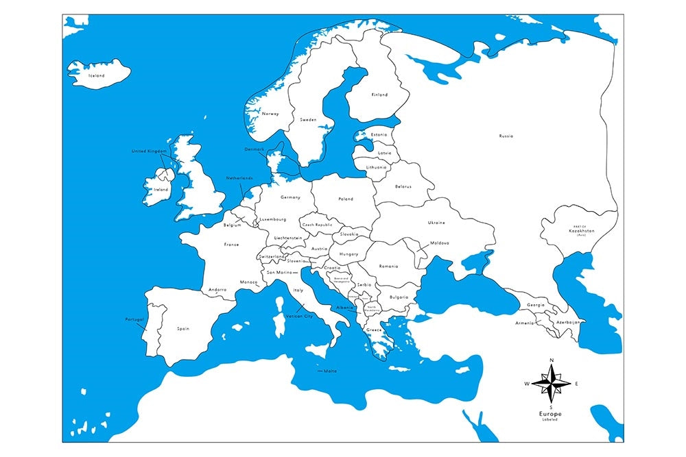
Labeled Europe Control Map
Labeled Europe Control Map
SKU: SKU:GEO-002-B
Regular price
$5.00 USD
Regular price
$5.00 USD
Sale price
$5.00 USD
Free shipping over $300 within Canada or to the USA.*
Quantity
In stock
Couldn't load pickup availability
This control map is labeled with the countries of Europe. Land areas are shown in white and water areas are blue.
Makes a great companion to our Europe Puzzle Map.
We have the Europe Flashcards (PDF), Countries 3-Part Cards (PDF), Flags 3-Part Cards (PDF) and Capital Cities 3-Part Cards (PDF) for working with this map.
Features
- Map measures 53.5 cm x 41 cm.
- Printed on heavy cardstock.
Recommended ages: 3–6 years.
- Returns accepted within 30 days
- Shipped every other business day
